One of my first projects working for Eden Prairie was to create a mapbook for the Assessing Department of Eden Prairie. The team used it as a reference tool for the neighborhoods located in the city limits. Check out a few pages below or go to bit.ly/2D2xytv for the full book!

View complete mapbook at bit.ly/2D2xytv
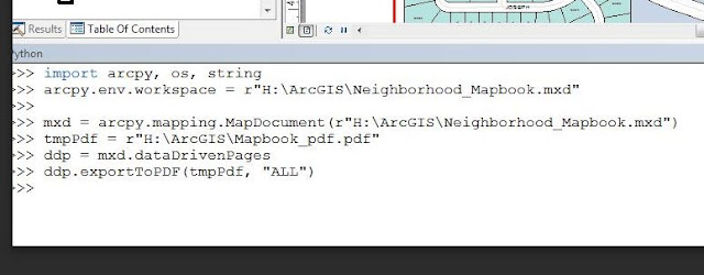
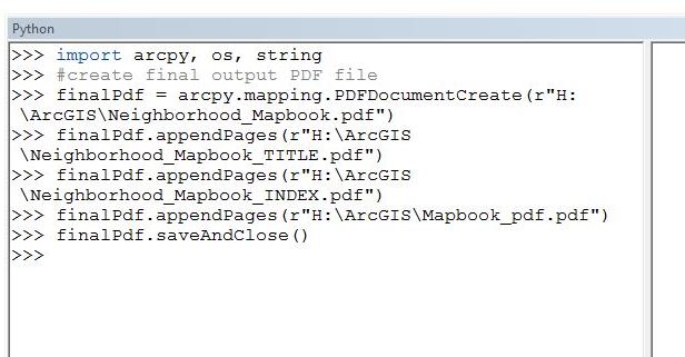
During the creation of the mapbook I was able to add a few fun python codes to my toolbox in order to manipulate lovely PDF documents. Check out the codes below!
 |
This code exported the completed mapbook pages into a PDF format. |
 |
To complete the document I appended the title page, index, and map pages together to create a final PDF of the project. |


